Wednesday, 14 October 2026


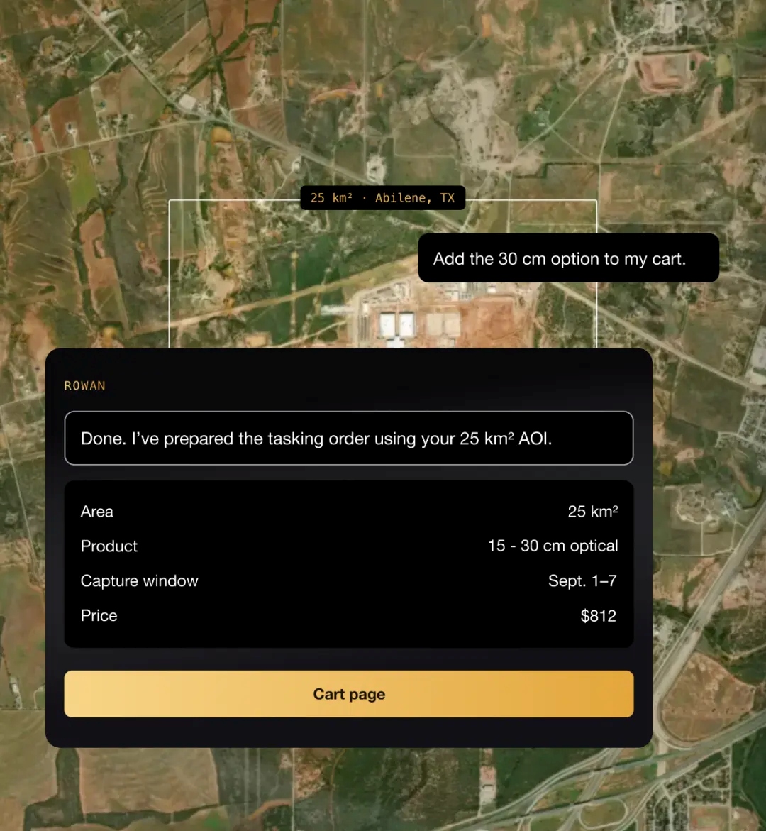
Image source: Public Domain
SkyFi, the leading Earth intelligence platform, announced the launch of Rowan, an AI navigator built into its platform. Rowan turns plain-language questions about any location on Earth into decision-ready answers. It searches SkyFi's satellite imagery archive and a user's previously ordered images, tasks new captures, recommends and runs geospatial analytics, and delivers results within the same conversation. Users do not need to know satellite jargon, sensor types, or GIS workflows to get an answer.
For example, a user can ask Rowan to compare recent satellite imagery of a data center under construction with imagery from one year earlier. Rowan searches SkyFi's historical archive for the earlier image, checks feasibility for a new capture, and returns a priced comparison the user can order in the same conversation.
"Our customers measure success in how fast they get to an answer. Is this construction site active? Has this coastline changed? Is this port busier than last month? Rowan takes the question and returns an answer grounded in Earth observation data, in the time it takes to ask it," said Luke Fischer, CEO of SkyFi.
What Rowan Delivers
Ask Rowan About Any Place on Earth
Built on SkyFi's Earth Observation Platform
Rowan draws on SkyFi's platform of more than 300 geospatial imagery sources and analytic partners, aggregated into a single searchable catalog. Rowan's recommendations are also informed by SkyFi's own experience running imagery tasking and analytics missions for commercial and government customers.
"We spent years building the infrastructure that makes Earth observation usable: the catalog, the pricing, the ordering process. Rowan turns that infrastructure into a conversation. Access was the first barrier we removed. Expertise was the one that kept most teams out, and that is the barrier Rowan is built to remove," said Fischer.